PAGASA’s preliminary report on Typhoon Tino (international name Kalmaegi) records two Cebu landfalls in the early hours of November 4, 2025: Pilar at 3:10 a.m. and Tabogon at 5:10 a.m. local time. The same report logs the highest 24-hour rainfall over land anywhere in the country outside Southern Leyte at the Lapu-Lapu City (Mactan) synoptic station, 183.0 mm, with 205.7 mm of storm-duration rain across November 2 to 6.
The water went where Cebu’s water always goes. The Butuanon River broke containment through Mandaue, and Cebu Daily News reported nine confirmed deaths in the city across Tabok, Paknaan, Cabancalan, Umapad and Canduman, with the worst inundation in Casuntingan, Maguikay, Paknaan and Umapad. In Talisay, the Mananga overflowed and destroyed riverside communities in Barangays Biasong and Dumlog; SunStar Cebu reported seven dead and six injured there.
The barangays that flooded in Tino are broadly the ones the geohazard map had already flagged. Cebu’s flood geography is durable. What changes is whether a foreigner signing a lease in 2026 checks the hazard data before paying a deposit.
This is the rental-check playbook: the waterways behind almost every flood event, the official flood-susceptible roster, the free tools that map a specific address, and what to ask the landlord before signing. It also states plainly what nobody publishes, because that gap is the reason the address-level check cannot be skipped.
The waterways that drive almost every flood event
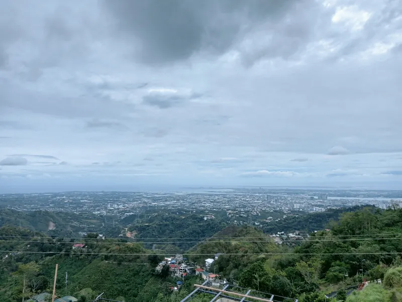
Cebu’s flood pattern is structural. The metro sits on a narrow coastal plain backed by steep upland barangays. Heavy rain on the highlands above Busay and Talamban funnels into channelled creeks and rivers that all run east toward the Mactan Channel, and the channels are narrower than they used to be. SunStar Cebu’s waterways special report names eight major Cebu City channels (Bulacao, Kinalumsan, Tagunol, Guadalupe, Mahiga, Lahug, Parian and Butuanon) and records that the city government had already flagged, as far back as 2013, that several had lost much of their original width.
Tino followed those channels exactly. The Butuanon runs through central Mandaue from the Tipolo and Casuntingan side down through Maguikay and Paknaan to Umapad on the coast, and that is the chain that went under. The Mananga drains the Talisay uplands, and Biasong and Dumlog are the barangays that sit on it.
The scale of what was already built there is the point worth holding onto. SunStar Cebu’s November 5, 2025 analysis of DPWH project records found 179 flood-control projects on four major rivers (Butuanon, Mananga, Cansaga, Cotcot) between 2016 and 2025, worth roughly PHP 17.44 billion, with more than PHP 11.10 billion of that on the Butuanon alone and about PHP 2.39 billion on the Mananga. That figure is flood-control spending, not typhoon damage, and it is routinely misquoted as damage. Both rivers overflowed anyway.
Cebu flood-control projects have since been inspected by the Independent Commission for Infrastructure together with DPWH, with findings and case referrals to the Office of the Ombudsman. The reported scope of that review is wider than the PHP 17.44 billion above, so do not treat the two figures as the same object. For a renter, none of it changes the decision. Price the address on the hazard map and the November 2025 water line, not on the next tranche of revetment money.
Forward-looking works exist. Cebu City and Mandaue signed Beyond Borders 4.0 on September 17, 2025, seven weeks before Tino, committing to six joint projects on the Mahiga and Butuanon by 2028, including flood-alert devices and trash barriers on both channels. Treat that as a plan, not as protection you can lease against today.
The 22 barangays on the official flood map
The institutional baseline is the Mines and Geosciences Bureau (MGB) Region 7 hazard map, whose 2018 edition lists 22 Cebu City barangays as susceptible to flooding. This is the map a city-engineer reviewer and an insurance underwriter will pull up, and it is the closest thing to an official answer that exists.
| Group | Barangays on the MGB-7 flood-susceptible list |
|---|---|
| Central / downtown | Kalubihan, Cogon Ramos, Day-as, Hipodromo, Kamagayan, San Roque, T. Padilla, Tinago |
| Mid-city and creek-adjacent | Guadalupe, Labangon, Mabolo, Tisa, Pardo, Sapangdaku |
| North corridor | Talamban, Banilad, Cambinocot, Pit-os |
| Upland / river-head | Lusaran, Pulangbato, San Jose, To-ong |
Two things renters consistently get wrong about this list.
First, it is not a ranking. Being on it does not tell you the depth, the frequency or which streets inside the barangay actually take water. Guadalupe and Banilad each cover ground that runs from a creek bank to a ridge.
Second, it contradicts the folk wisdom. Banilad, Talamban and Pit-os all appear on the official flood roster, and all three get recommended to foreigners as safe high ground. Both statements can be partly true at the same time, which is precisely why the barangay is the wrong unit of analysis. The address is the unit.
What nobody publishes, and what we will not invent
There is no published, barangay-level map of where Tino’s floodwater actually reached in Metro Cebu. Not from NDRRMC, not from the city DRRM offices, not from MGB. The casualty record has the same shape: the Office of Civil Defense tally of November 17, 2025 (reported by GMA News and SunStar Cebu) gave 269 deaths nationally with 150 in Cebu province, while NDRRMC Situational Report No. 30 of November 26, quoted inside PAGASA’s own preliminary report, gives 253 deaths, 502 injured and 119 missing, each marked under validation, with damage to agriculture, infrastructure, housing and other assets at PHP 1.33 billion. Both are real official numbers at different validation stages. Neither is broken down to city or barangay level.
So we do not publish a list of Cebu barangays that “stayed dry” in Tino, because no such list has been verified and building one from anecdote would be worse than useless: a foreigner would sign a lease on it. What we can say is what the official map says, what the reported damage concentrations were, and how to resolve your specific address in fifteen minutes. Our full sourcing rules are on the methodology page, and the datasets we do maintain (and the ones we deliberately leave empty) are catalogued at /data.
The three-tool verification walkthrough
A specific address either is or is not on the hazard footprint. Three free tools answer the question in under five minutes.
| Tool | Operator | What it answers | What it will not do |
|---|---|---|---|
| HazardHunter PH | PHIVOLCS + DENR-MGB + PAGASA | Composite flood, landslide, storm-surge and earthquake rating for a dropped pin | Give you a depth, or a Tino-specific water line |
| Project NOAH | University of the Philippines | Finer-grained creek-overflow modelling; a second opinion on the same pin | Agree with HazardHunter automatically. Where they disagree, treat the worse rating as the answer |
| DREAM LiDAR (LiPAD) | University of the Philippines | Elevation in metres, which is what settles two candidate addresses on one creek | Model the drainage, the gutters or the building pad |
A low rating is not immunity. Tino’s rainfall exceeded modelled return periods across large parts of the Visayas, which is exactly the condition under which a “low susceptibility” pin still takes water. But a high rating is a structural answer, and the only rational response is a lower floor plan than you wanted, a lower rent, or a different address.
What to ask the landlord before signing
Three questions, in order. Most landlords answer the first. Fewer answer the second. The third tells you whether anyone has ever actually thought about the building’s flood profile.
One: what was the November 4, 2025 water line at this address? Tino is the reference event now, and it is recent enough that an honest landlord knows the answer within a few centimetres. A landlord who does not know is either new to the property or has not been on site since the storm. Ask the neighbours the same question and compare.
Two: where are the building’s electrical room and main water pump? Ground floor and basement are the norm, and both flood out well before the water reaches a residential floor. A raised, mezzanine or rooftop installation is the difference between a building that stays livable and one that goes dark with you inside it. This is the question that separates a dry unit from a functioning home.
Three: what is the parcel’s elevation, and how far is it from the nearest channel? The number is on the topographic survey for any registered title, and the LiDAR portal will give you an independent read. There is no published safe threshold, so treat this as a comparison between candidate addresses rather than a pass-fail test. A landlord who will not discuss it at all has told you something.
Pair the answers with the complete renting guide for Cebu, the hidden costs of renting, the security-deposit law, the Mandaue neighbourhood guide and the typhoon preparedness playbook. Flood exposure is a line item in the monthly cost picture, not a separate topic.
Insurance, and the honest limits of it
Philippine home and contents policies are built on fire and allied perils. Typhoon, flood and earthquake come as an acts-of-nature extension that you have to ask for and pay for, and a policy bought without it will not respond to a flooded unit. AXA Philippines lists acts of nature (earthquake, typhoon, flood) as a covered section of its Home Security package, and several other non-life insurers write comparable extensions on a fire policy.
Premiums are the part where the internet lies to you. Pricing is set per sum insured and per address, none of the insurers publishes a verifiable rate card, and any peso-band figure you find in a blog post (including one that was previously in this article) is unverified. Get a written quote keyed to your actual contents value and your actual address, and bind it before a storm is named on the PAGASA tracker. Cover taken out after a named storm typically will not respond to that storm.
A flood-prone address can still be the right choice if the rent reflects the risk and the floor plan keeps your bedroom and your electronics above the water line. A flood-prone address at the market rent of a dry equivalent is the failure worth catching before the deposit changes hands. The verification costs fifteen minutes; getting it wrong costs everything you keep on the ground floor.
FAQ
Frequently asked.
Which Cebu barangays are officially mapped as flood-prone?
How do I check if a Cebu address is flood-prone before renting?
How bad was Typhoon Tino in Cebu?
Does a higher floor in a Cebu condo solve flood risk?
Does Philippine renter insurance cover flood damage?
Data note. Prices, rates, and details are verified as of publication and may change. Always confirm with the listed provider or landlord before committing. This article is informational, not financial, legal, or immigration advice. Full disclaimer.